6/2/11 – Yellowstone National Park


These "colorful" signs were posted all over the place
Our first full day in Yellowstone, we planned to drive north on the park road past the Norris junction all the way to the Mammoth Hot Spring Terraces and the northern entrance to the park. As we drove, we pulled over at each geyser basin along the way to get out and walk the boardwalk that encircled the springs and pools of the basin. These boardwalks were constructed to keep visitors primarily from destroying the delicate cave-like formations that exist around the park’s features, but also to keep them from having the chance mis-step crack through the thin calcite crust that covers the flesh-rending thermal activity below the surface.
Mammoth Hot Springs
Driving through the park, we kept switching through to very different worlds- one that was still very covered with tall packs of snow and ice, reluctant to allow spring to get a foothold. The other were these places where the earth was reaching up through the dirt, boiling water and mud, burning holes through the dirt and killing off the trees when they get in the way. These places you could always smell the sulfur as it steamed and bubbled, sometimes more caustic than battery acid, dissolving the rocks around you.
Check out the height of the built up travertine rock!
The most impressive were the formations of the Mammoth Hot Springs, an entire mountainside of formations from the various hot springs that tumbled down its slope. These formations had built cascading terraces; some as large as baths some so small that they looked like the finest ripples in sand- each one damming enough water for the minerals it carried to deposit and build the walls higher. We had seen similar formations when visiting Carlsbad Caverns in New Mexico. Here in the open air, most strikingly the formations from inactive hot springs. Although the entire hillside was covered, only in a few places was water still trickling down feeding the living bacteria and thermophiles that gave the living formations their brilliant colors. In this area, you could see visibly how quickly the earth was changing. In some places, the rock had formed killing the pine trees and then burying them up to their tops in rock before they could rot or be removed. Along the boardwalk, signs denoted that in some places, as much as a foot of the rock called Travertine was deposited every year!
We loved the old sign above Park's in Gardiner


Running low on supplies, we exited the park through the north gate and drove to the nearby town of Gardiner where we visited the local fly shop and grocery store. Beneath a beautiful old hand-made sign, Parks Fly Shop was on Main Street. Inside the shop, the air was full of the smells of the furs and feathers used to tie flies, and noticeably quiet- a sound that is likely in short supply during the right time of year. The shop reminded me of my grandfather’s office (also where he ties his flies). The two gentlemen in the shop were more than happy to chew the fat about the current fishing conditions for a spell while Sam napped in the warm car. With fresh groceries, a map, and a plan, we headed back into the park stopping briefly to buy a shower in the Norris Junction Hotel. Because most of the hotels scattered every 80 miles through the park have community facilities for each hall (because they were built prior to the advent of all rooms having private bathrooms) the park never built shower facilities in the public campgrounds.
As we finished preparing dinner, we were hit by an unusual (to us) snow shower which laid a thin blanket of snowflakes shaped like small pieces of Styrofoam on the ground around camp and the roof of our car. As the snow drifted down from the clouds, each flake was so large and round that they could be felt as it pelted your face and clothing. After a brief phone call home, we received word that the rest of the world was in fact still normal and that the temperatures in Charlotte had been in the high 90’s all week with unbearable humidity. Hopefully we would find some sweet middle ground once we reached Colorado.

6/1/11 – Yellowstone National Park

When the sunlight rolled over the ridge to the east and struck the snowcapped mountains, the aspen trees surrounding the Jeep seemed as if they were covered in gold leaf. We woke up slowly and went about packing the car for our next big stop- Yellowstone National Park. Yellowstone had sort of taken on a sort of holy land persona to me over the course of our trip. As we traveled from one national park to the next, each one had managed to blow my mind a bit more than the last, Yellowstone was going to have a lot to live up to.
The transition from the Tetons to Yellowstone was fairly anticlimactic. For some reason, looking at the atlas had not impressed upon me that the two parks were connected north to south. If not for the park gate, there would have been no way to tell one park from the other until you began to pass the first steaming pools near Old Faithfull. The biggest difference between the two parks was the elevation; as we entered Yellowstone, the banks of snow that lined each side of the road were at times over 15 feet tall, and Lewis Lake was still hidden behind a snow-covered sheet of ice!
Being near the southern entrance, the Old Faithfull lodge and visitor center were our first stop. Here we lingered only a few minutes in order to purchase a fishing license and find out which sections of the park were closed from the snow. We also knew how Yellowstone was like to fill to capacity in the warmer months, but we were hopeful to find a campsite within the park grounds. We arrived and found that we would likely have our pick of the parks campgrounds. As we poked around the geysers near Old Faithfull, I began to realize that the low-tide/ rotten-egg smell of sulfur would be a common theme near the park’s many sites of geothermal activity.
Once deciding that we should finish the drive to the campground as soon as possible, we glanced into the great Old Faithfull Lodge just as a tour of the building was starting. We followed the tour group around for a few minutes gaping upward at the monolithic pine beams that spanned the four story lobby in disbelief at the scale of the building. We ducked outside in time to reach the far side of Old Faithful just as the geyser blew its top. As the steam and tower of water subsided, a wave of applause and cheers drifted over to us from the hoard of camera toting tourists with chubby little children double fisting ice-cream.
As the afternoon wore on, I began to understand how large the park truly was. When we reached the Madison Junction Campground, Sam checked in at the front desk and reserved our Campsite for the next three nights to ensure we would have a place to stay as we toured the park while I used the old ice machine and picked up a 10lb block of ice. As soon as we reached the campsite, I dug out my waders and fly rod and headed towards the river on the far side of the campground. The water was like a coastal black-water river in the Carolinas; the water dyed a black tea color by the organic matter that all the melting snow was filtering through as it entered the river. Although I hadn’t had any success fishing, the grassy banks of the swollen river were the perfect way to enjoy the last rays of sunshine before retreating to the campsite for dinner to the chorus of RV generators.

5/31/11 – Grand Teton National Park


In the morning after only a couple hours, we had reached Jackson Hole Wyoming, a town that seemed to be made up almost entirely of outdoor enthusiasts. Also the home of Mountain Khaki’s- one of my favorite brands of outdoor clothing. As I spend so much time at work selling their product, I decided to drop in and pay a visit to the designers that work in Wilson, WY- a sort of suburb of Jackson Hole. The small studio consisted of only one room in a modern commercial building tucked almost seamlessly into the small community between the mountains and a babbling mountain stream. 
The two designers and their husky were very welcoming and excited to meet visitors that had come so far. They inquired about the Bill Bartee and life in general at Jesse Brown’s in Charlotte, reaffirming my appreciation of the small size of the company and the personal relationships they keep with their vendors. We left there with a hand drawn map to some local attractions and felt as if we had made some new friends.
After we entered the park and began to review the maps we had received at the gate, it quickly became apparent that the majority of the hiking trails and attractions would still be closed due to the record setting snowfall that had accumulated during the winter. 
According to the ranger station, the snow pack was somewhere between 230 and 250 percent of the annual average- giving us a milder view of the mountains as they would appear in winter rather than the full summer we were experiencing back home.
Like a jagged pile of broken porcelain china, the line of mountains jutted skyward out of the flat sagebrush and pine covered flat lands. The sheer snow covered faces of the Teton range demanded at least a few hours of sitting in wonderment. Sam had a hard time believing how anyone could climb to the summit of Grand Teton and ski down, the subject of an exhibit in the visitor center museum. I think next year, I’ll have to take her up to Brevard to watch the Banff Mountain Film Festival or at least the Radical Reels Tour as they make their rounds there.
After driving the road that loops around the center of the park, we found our way to the campsite suggested by our friends at Mountain Khaki on the adjoining US Forest Service land. 

As we cooked and ate nestled in the aspen grove, we had the perfect view of the sunset as it glowed from behind the jagged peaks of the Teton Mountain Range.

5/30/11 – Grey’s Creek, Wyoming


Another long day on the road headed toward Grand Teton National Park, we left early and soon found ourselves on the belt-loop surrounding Salt Lake City, Utah. It was interesting to see the city as it sprawled into the surrounding suburbs yet downtown remained nestled into the base of the mountains. As appealing as it was made to sound, we opted to forgo a dip in the great salt lake being as the ground was still littered with snow and the wind was blowing a cold front through the area. 
 Salt lake soon gave way to more mountainous highway as we wound our way through the towns that surrounded Bear Lake- a place known for its raspberries and summer water sports, each town seemed more deserted than the last.
Bear Lake


As we drove, it became apparent that we wouldn’t be making it to the park that day, so as we wound our way north having dipped our foot into the state of Idaho, we now found ourselves driving north on highway 89 alongside the flooded Snake River in Wyoming. Passing through each small town, we were looking for any of the recognizable signs for forest service land where we could camp for free. Thankfully, in the town of Alpine, some helpful women at the grocery store were happy to help direct us towards our campsite for the night. 
A long dirt road riddled with pot-holes ran along the side of the raging Grey Creek taking us away from the world of pavement- for a few hours anyway.

5/29/11 – Beaver Utah


With these writings, I intend usually to document our adventures in such a way as to inspire others towards having adventures of their own. On this occasion, I personally would have a difficult time saying that the plan we executed was a good idea. With our final day in Zion, we decided to try one of Zion’s longer hikes to see one of the world’s largest freestanding rock arches. The hike was about 14 miles round trip and it was after noon by the time we reached the trail head from the park’s remote northern entrance. The weather that day had decided to be less than cooperative, making for a chilly and terribly windy hike.
The first section of the hike I must admit surprised me with yet another hidden gem of landscape as it wound down towards the river through a seasonally riparian meadow. The stream kept twisting back and forth forcing the hiker to hop from rock to rock in its crossing. Should one ever tire of this landscape, the peaks of the mountains surrounding the Zion canyon were always visible to make you wish you had a camera that could capture them the way we could see it.  Soon we left this pleasant sheltered area for a harsh dry landscape full of stunted pine trees and deep footprints in the now hard dried mud of the trial. After what seemed like an eternity, we reached the arch. Rather than being neatly beside the trail, the trail ended in an area of trees beside a creek with the only indication of where to find the arch being one that someone had scratched into a trail sign that read “look up” with an arrow. High up above where we were, jutting out of the side of a cliff maybe a thousand feet above us was the red rock arch. Following another brief four hour jaunt we arrived back at the car gratefully before dark and completely exhausted.
Of all the expenses of our trip, our stay that night in the near-by town of Beaver at the Old Country Inn may have been one of the most appreciated.

5/28/11 – Zion National Park


In the morning, as our two parties breakfasted, we said our goodbyes and exchanged contact information. Because Aurora was with them, in nearly every park, Brad and Courtney were extremely limited as to which trails they could explore. We, on the other hand had nothing holding us back from setting our sights on the most ambitious trails in the park. The Virgin River Narrows is a section of trail that winds down through one of the most alien canyon landscapes in the park. These long hidden corridors of carved red rock are the most frequently depicted in imagery of Zion National Park.
As we rushed to beat out the herds of other humans for one of the few permits to hike through the Narrows, we had forgotten to generate our plan B. I reached the permitting desk in such a hurry that I failed to notice the sign behind the counter explaining that the “Narrows” would be closed for another few months due to flood stage water.
With no idea what would make a good second best place to visit in the park, we jumped on the shuttle and headed for a trail labeled “Hidden Canyon” near the end of the line. The trial was only listed as one mile long, so we had planned on seeing what lie at the other stops on the bus route after exploring here. The hike as it turned out was quite steep, and Sam was keeping a surprisingly quick pace for having short legs. Whether it was from pent up energy after days of sitting in a car or the fact that I was experiencing the reverse effect of sitting in a car for too long, we soon reached the final section of the trail leading to the mouth of the canyon.
The last few hundred feet were worn and slanting steps hewn out of soft sandstone (more sand than stone it seemed) with lengths of heavy metal chain pinned to the cliff side with pieces of rebar to hold onto.
The narrow walls of the shady canyon were brimming with lush green plant life, swaying in the warm breeze that blew up from the sun-baked rocks below. The delicate ferns and mosses seemed to thrive everywhere the water filtered out of the sandstone to collect in clear cold pools around the boulders along the canyon. As we proceeded upward through the canyon, the types of rock to either side of us changed from soft sandstone to harder types of sedimentary rock and patches of volcanic rock as well. The canyon walls seemed to beacon those with the inclination to climb rocks. After lunch, we reached the second of two free standing arches that were found in the canyon. There still seemed to be no end to how deeply the canyon went.
Invigorated by the endless scrambling and kept fresh by the cool breezy temperatures, it was hard to convince ourselves to turn around before we had to, but the remaining daylight was fast becoming our biggest enemy.  

Exhausted by the time we reached the bus stop, the ride back down to the visitors center gave us time to both relax as well as bask in the glory of having seen such wonderfully remote and intimate landscapes as the inside of that canyon without having to hike for days and days off trail.
After leaving the park to seek out our campsite, we wound our way up to the reservoir finding an incredibly unique landscape that few likely knew existed as a part of Zion National Park.
At this higher elevation, we found breathtaking alpine meadows nearly flooded with the amount of snow-melt from the previous winter. The hillsides up here were mostly private ranches, but when we reached the small campsite, the wind and temperature had us both glad that there were no available spaces. As we descended the plateau back down beside the Virgin River, we were blessed with one of the most fantastic sunsets of the trip to date. With the Zion peaks in the background, the thin clouds lit up in a symphony of oranges pinks and purples, bringing perfect closure to such a majestic day.

5/26-27/11 – Grand Canyon, North Rim


After hours of driving towards the desert with line after line of carved rock cliffs looming out of the distance, we pulled off the road to investigate one of the many roadside stands where Navajo families would sell their arts and crafts to the tourists that pass by.  We finally emerged facing a ridgeline that could only be a part of the Grand Canyon, yet we still could not see any hint of the Grand Canyon I knew from pictures and movies. After checking the map, they were in fact the Vermillion Cliffs of the Colorado Plateau. As we wound our way closer to this ridgeline, we crossed a bridge that caught us both unawares. As we crossed a bridge, the ground fell away into a canyon dropping nearly 500 feet to the river below. When we stopped to take a picture, we learned that this was indeed a part of the Grand Canyon and that the dam that released the Colorado River water into the gorge was only a few miles upstream.
We drove down to the nearby river access at Lees Ferry and quickly got our fill of the frigid 43 degree water. We watched the enormous expedition rafts launch off of the 60 foot long trailers it took to haul them. Groups of excited rafters surrounded us doing final checks of their equipment packed neatly into different colored dry bags. A quick stop at the local fly shop aided me in deciding that a day of fishing here might be disappointing due to the high flow level, and soon we continued our trip towards the north rim of Grand Canyon National Park. The landscape leading to the park quickly changed from desert to rolling hills covered with tall conifers, broken up by expanses of lush green alpine meadows. Small streams and pools of icy cold snow melt spotted the landscape while areas of near constant shadow still protected snow drifts, remnants of the intense winter. The 40 mile stretch of road leading out to the remote North rim of the canyon was the most lush landscape we had seen since leaving Charlotte!
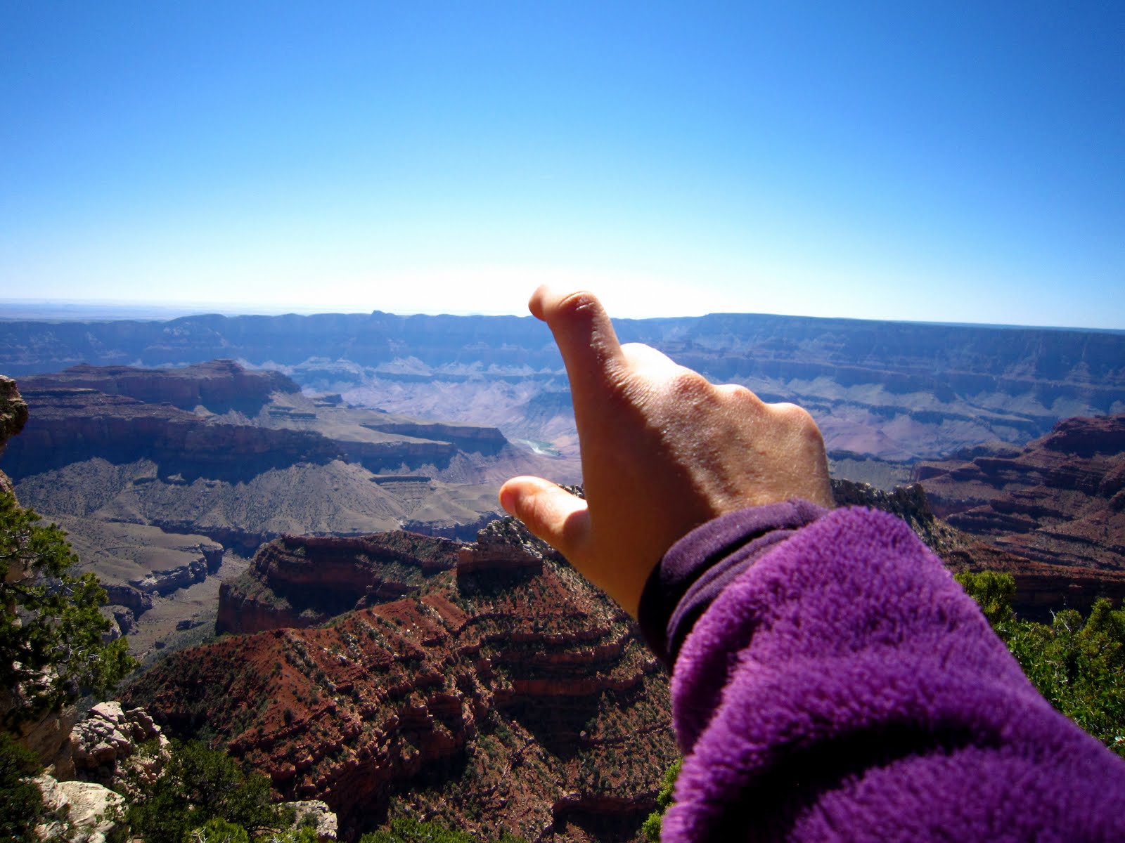
Even now I find myself unable to describe the vastness of the canyon. Our first view being from the lodge, and later from the overlooks that dotted the canyon rim to either side of it, it was quite obvious that it would be impossible to see the entire expanse of the canyon from any one point. After finding one particularly nice overlook, we rushed back to the car to cook a quick dinner so that we could return in time for the sunset. As we watched the colors wash over the layered rock of the canyon, we found ourselves ill prepared for the temperature and the wind.
After finding a campsite outside of the park, we spent the next morning visiting some of the more remote overlooks on the north rim. From cape Royal, we were able to see all the way down to a section of the Colorado River giving the most complete sense of scale possible from the north rim.
As we prepared to leave by enjoying a brief shower near the park campgrounds, we met a nice young couple and their dog who were traveling from Ontario to British Colombia via a number of national parks in the U.S. Brad and Courtney and their collie/sheppard mix- Aurora had uprooted themselves following work across the continent and were making an epic go of it. After discovering that we were both headed to Zion National Park next, we joined forces and caravanned the reasonable 5 hour drive North.
As we entered Zion, having planned to make an early camp and enjoy some delicious camp food with our new friends, we were forced to pull over just to gawk at the breathtaking canyon that engulfed us. The road into the park twisted for miles through what seemed to be quilted and patterned rock formations, broken up by passing through first, a tunnel drilled through rock solid enough that no re-enforcement was needed, and later through a low ceilinged tunnel over a mile long lit only by the headlights of the cars passing through it. About every quarter mile, a window would appear for only a split second giving the passenger a terrifying glimpse out and down into the dizzying abyss.
Unfortunately, the realization that we had arrived here on Memorial Day Weekend came a bit too late. We didn’t have any trouble finding the plot of land later described by a ranger as our “refugee camp” for the night. Crammed into a lot about 1 acre in size we parked side by side along with probably two dozen other vehicles full of campers. Thankfully, the bawdy crowd settled down in time for us to sleep after sharing stories and comparing our two countries for hours after dinner.

5/25/11- Flagstaff, AZ


Having left the last of the planned architectural sites behind, we were looking forward to the next phase of the journey involving towering landscapes and mighty rivers- on a scale that should have no trouble blowing my mind. Our first glimpse of that were the red rocks of Sedona, Arizona. We didn’t stay long in Sedona, the “Pink Jeep Tours” spoke volumes about the fact that the entire town was just out of our price range. When we stopped to inquire about divey little resteraunts or a dirty bar that possibly had a white guy with dreadlocks that could serve you a craft beer and a burrito- we were nearly laughed out of the tourist information center. Winding our way up through the mountains from Sedona offered us some breathtaking views of the red rock canyons and rivers that had shaped them.

We emerged from the mountains in a foreign landscape of alpine wilderness, as we approached the town of Flagstaff, we spotted the first snow on the trip. High up on the nearby mountains, we could hardly understand how there could be any left after the heat and dry climate of the places we had been in the past week. Flagstaff turned out to be a very cool little town- it’s people young and lively, there was a palpable appreciation for the outdoors evidenced by the number of bicycles, pedestrians, and outdoors shops.
Humphreys Peak, near Flagstaff AZ: Elev 12633
Best Hotdog Restaurant Ever!

After getting the scoop at a local outfitters on where to camp for the night, we ate what I would argue was one of the best hotdogs I’ve ever had at a miniscule hotdog restaurant in town and a beer from a local taphouse, we navigated easily to a local camping spot in the nearby national forest. On our way out of town as we stopped for gas and groceries, we found a string of Tibetan prayer flags to give us continued good luck and to decorate the Jeep. In our short time in Flagstaff, we became quite fond of its wealth of unique independent stores and restaurants, many occupying the same old buildings that remained along the corridor of Route 66. 
With a similar vibe as Asheville, NC only on a smaller scale, we would love to spend more time enjoying the old buildings with their elaborate and dated neon signs.